Oklahoma State Flood Plan
Oklahoma Water Resources Board
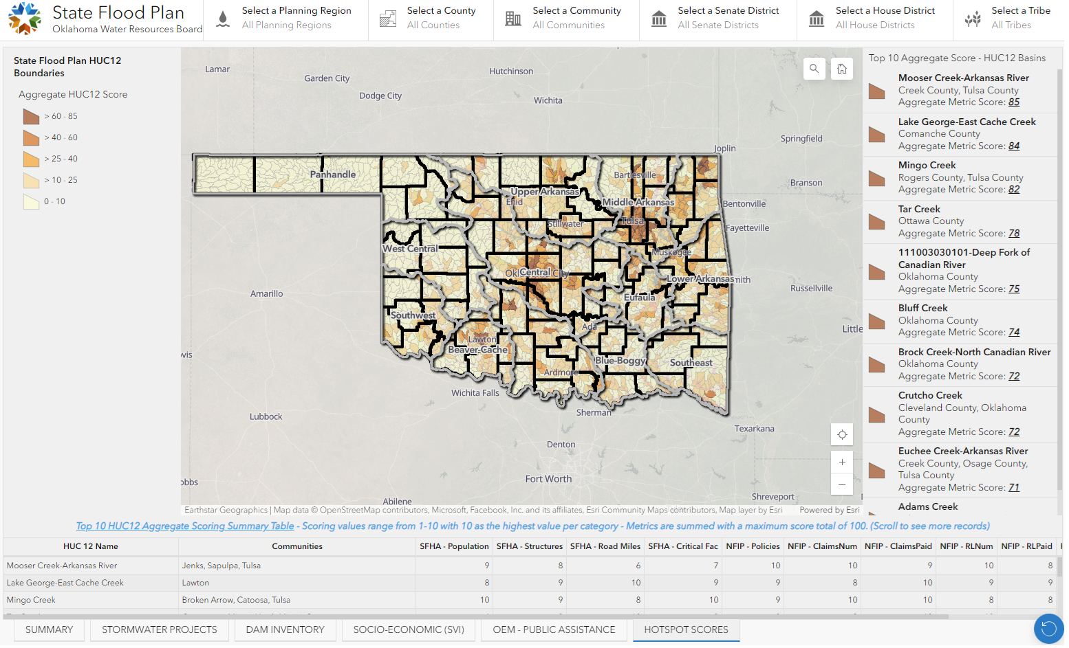
The Oklahoma Water Sources Board (OWRB) needed to create a statewide Flood Plan to reduce flood risk for the State. This required collecting and analyzing numerous federal and statewide GIS datasets. Because of the ability to display analysis results easily and intuitively, ArcGIS Dashboards were a natural fit for the project.
Together with traditional report documents, the GIS Dashboard acts as the primary reporting tool of the State of Oklahoma Flood Plan. Datasets gathered and analyzed included floodplain extents, building locations, population distribution, National Flood Insurance Program policy and claims data, local mitigation projects, dam locations, socio-economic vulnerability index (SVI) distributions, past locations of public assistance spending, and hotspot mapping for all this information. Users can filter statewide datasets by County, Community, watershed, legislative district, and by Tribal boundary.
By utilizing ArcGIS Dashboards, OWRB was able to help communities discover their flood risk and identify mitigation funding opportunities. Meshek and our team partner FNI developed the data and Dashboard for OWRB and deployed it into OWRB’s system for their staff to use and maintain. Completed in 2023, it has also been used in coordination with local officials to help identify potential actions in response to the deadly 2024 tornadoes which struck many areas of the state, including areas also exposed to flood risk.


