
May 2019 Flood: Arkansas River Floodplain Analysis
USACE Tulsa District in Tulsa, Muskogee, and Sequoyah Counties, Oklahoma
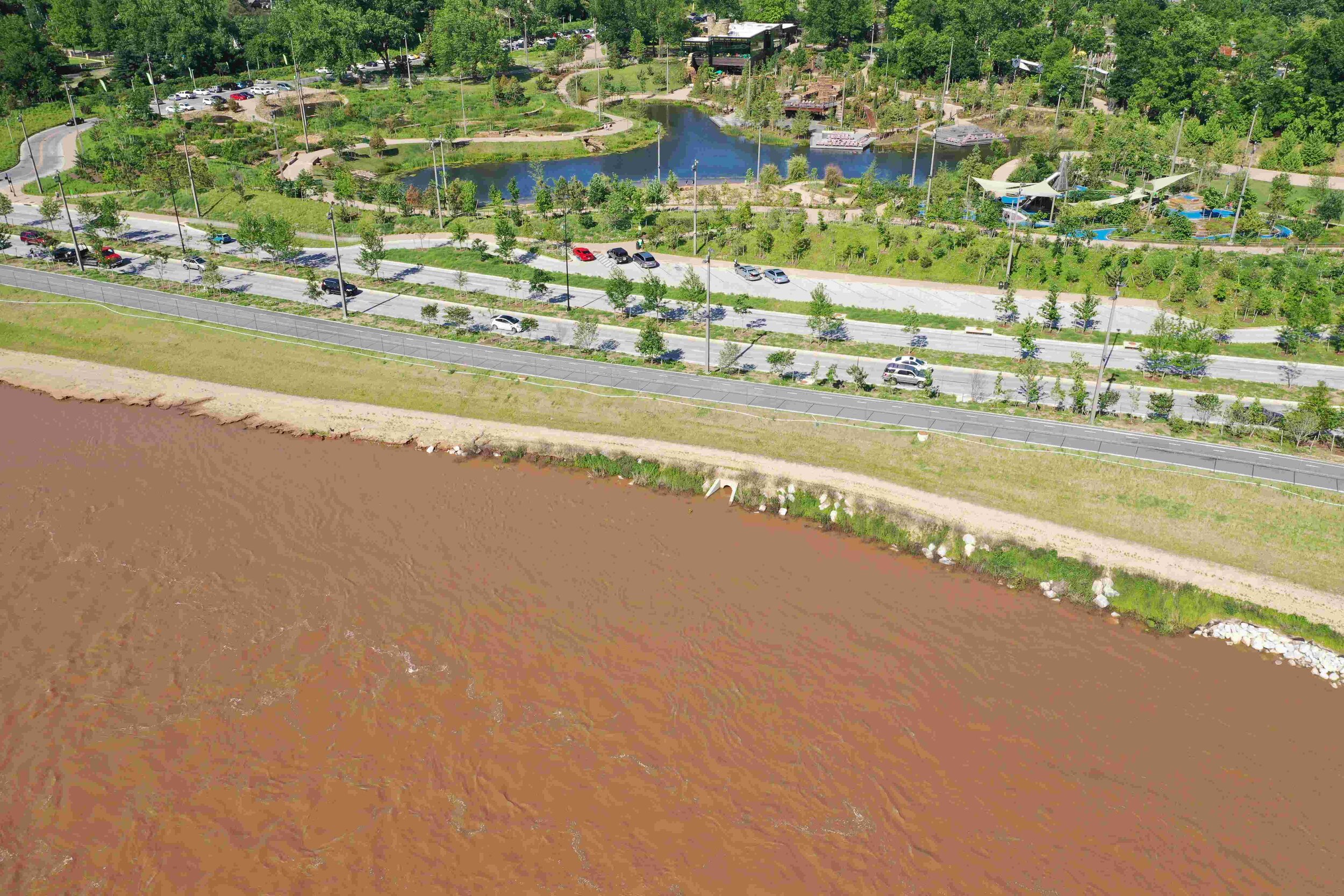
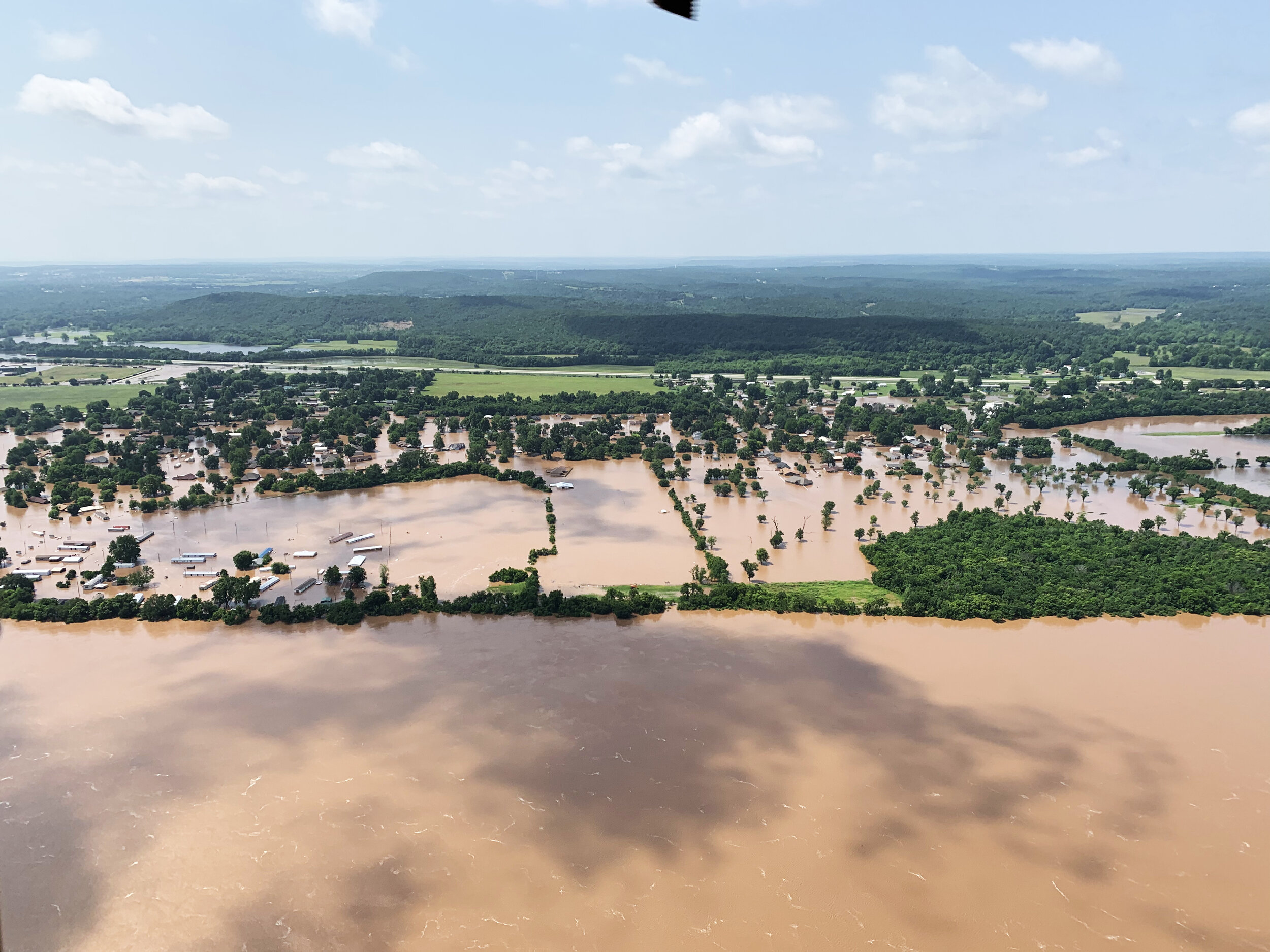
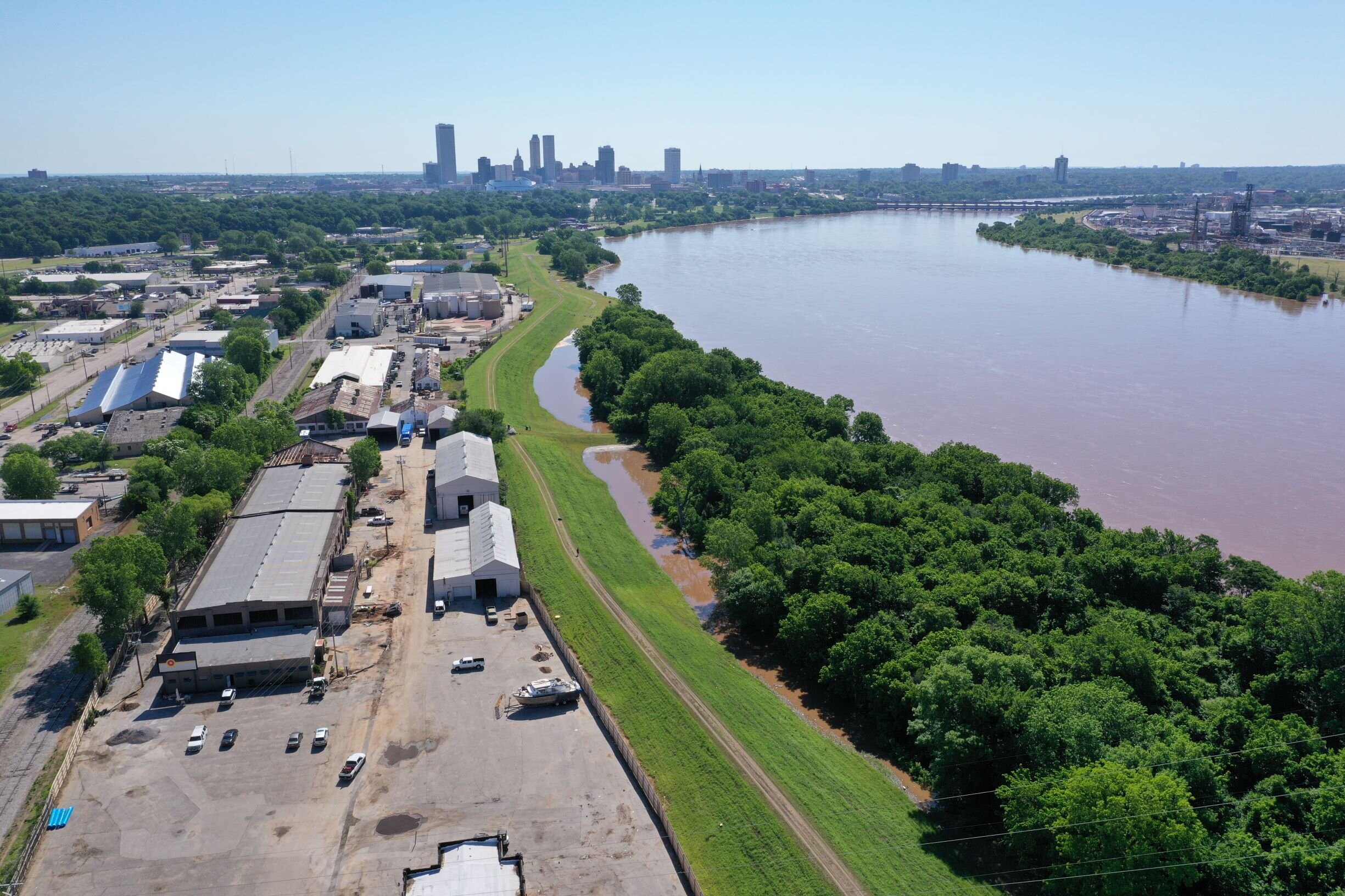
The May 2019 regional flooding disaster in Arkansas and northeast Oklahoma triggered historic impacts throughout the Arkansas River watershed, with some towns largely or completely submerged. Meshek assisted the City of Tulsa, the US Army Corps of Engineers, other regional stakeholders, and the public by mapping and identifying the growing flood risks during the disaster.
Federal and local terrain datasets were mosaicked to model and map flood scenarios. Inundation mapping was updated as forecasts changed. Web maps were issued to the public to aid in preparation during the event.
Following the disaster, the US Army Corps of Engineers (USACE) Tulsa District hired Meshek & Associates to expand and refine this impact analysis along the Arkansas River.
In the first few meetings, it became apparent the resources provided by FEMA, the Small Business Administration (SBA), insurance, and other participants, were not enough to help communities fully recover. County commissioners and USACE requested that Meshek coordinate and facilitate a meeting to determine the potential of supplemental disaster appropriations. The request and meeting focused on two Housing and Urban Development (HUD) programs: The Community Development Block Grant — Disaster Recovery (CDBG-DR) and The Community Development Block Grant — Mitigation (CDBG-MIT). The meeting included local, state, and federal officials, along with a Congressional Delegation.
Two months after the meeting, HUD announced an appropriation of $36 million in CDBG-DR funds. Meshek & Associates has continued to be involved at the local level in anticipation of the CDBG-DR funds in Oklahoma. Our planning and grant team the use of these funds to meet the local cost share requirements of FEMA’s Hazard Mitigation Assistance programs.
This experience continues to be heavily relied on in the areas impacted by the 2019 flood event as communities navigate the vast array of recovery programs. In response, Meshek developed many datasets, maps, and dashboards to highlight unmet needs and identify low to moderate income populations. These included analyses of the extent and depth of flooding against the buildings, critical facilities, populations, transportation routes, and concentrations of National Flood Insurance Program policy holders likely to be impacted by future flood events.